


Q&A on Visual Positioning and Leica GS18 I

Product EngineerMetka Majericanswers questions on Visual Positioning technology and the Leica GS18 I GNSS RTK Rover.
What are the challenges when surveying with a conventional GNSS sensor?
To be able to measure points, a GNSS sensor needs to receive satellite signals. The position of a point can only be measured when the GNSS RTK sensor hasaccess to the open sky and the pole tip is physically in reach of the point. If this is not possible surveyors can use alternatives methods such as:
- Different workarounds e.g. taping offset, using COGO functionality and sketching
- Additional equipment in combination with the GNSS RTK sensor e.g. CS20 withintegrated悬臂或4米杆。这种测量方式可能是耗时的,也可能损害准确性。
- Alternative sensors like total stations. Using such alternatives can also be time-consuming, when there are only a few points that cannot be measured with a GS sensor.
Users face an additional challenge, whena lot of detail needs surveying。用杆尖来测量每个点需要大量时间在现场。还有一些遗漏的风险,需要重新审视该站点,从而导致额外的费用。
How does the Leica GS18 I overcome those challenges?
与GS18我不需要使用其他时间-consuming methods or additional equipment. Due to the integration of GNSS, IMU (Inertial Measurement Unit) and a camera, the points with obstructed view to the sky and other inaccessible points can be measured from images using the Visual Positioning technology within GS18 I. This new technology allows points of interest captured from a distance to be measured with survey-grade accuracy.
In which situations would surveying professionals use Visual Positioning technology?
Visual Positioning is particularly appropriate for:
- Mapping hundreds of points.
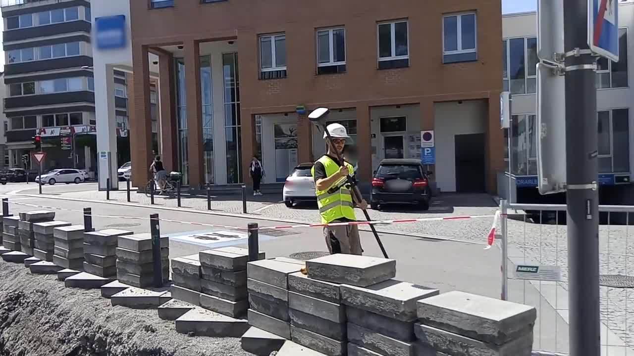
- 测量无法访问的点,例如在繁忙的街道上,门后或危险区域(例如,在屋顶边缘上受到狗,有害公用事业的攻击的风险)。
Figure 1 - Leica GS18 I GNSS RTK rover while measuring points over a fence

- Surveying points in places with GNSS signal obstruction (e.g. under a roof, balcony or tree).
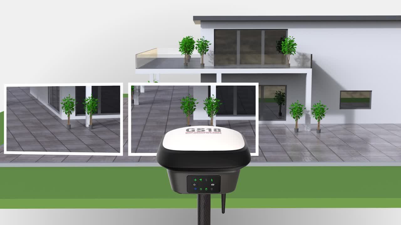
- Measuring points on the façade of a building (e.g. corners of a window and height of the roof).
图2-测量FAçades

- Measuring additional points without the need to revisit the site.
- 生成捕获对象的点云。
Figure 3 - Point cloud generated from image groups captured with GS18 I

- 库存的数量计算。
- Capturing images of a crash scene for point measurements.
Figure 4 - Capturing a crash scene

Who should use a GS18 I?
GS18 I is designed for users who need to easily measure points that are challenging to reach with a conventional GNSS RTK rover. The GS18 I is the ideal tool for users to collect large amounts of data onsite. Users can decide later, which points to measure in images survey-grade accuracy.
How does the GS18 I work? (Measurement principle)
Let’s take the following video as an example.
用户想测量沟槽中的某些兴趣点。所有需要做的就是沿着沟渠行走,相机指向管道,而GS18我会自动捕获图像。GS18 I以2 Hz的速率捕获图像,以确保最佳图像重叠和几何形状。一旦停止捕获,图像将通过Captivate上运行的算法自动处理。处理捕获的图像后,可以将图像用于点测量。
During capture, GS18 I checks whether the position and tilt quality are sufficiently accurate. If not, the capturing is automatically stopped, but the images that were already captured are processed. In addition, GS18 I establishes a geometric connection between consecutive images by extracting features (distinctive points) from images.
以下视频显示了在GS18上运行的算法如何跟踪捕获过程中的功能:
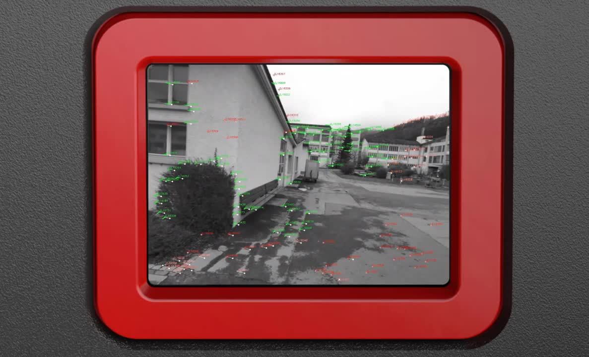
这些图像可立即用于点测量。视觉定位技术使这成为可能。
Which software is needed to process captured images?
GS18 I is fully supported by Captivate software running on the CS20 LTE or BASIC controller or the CS35 tablet.
Captivate will automatically process, position and orientate the captured images, therefore ensuring quality control already on site. There is no need to match any reference points or lines manually, as required when using similar technologies.
How can points be measured in images and which software is needed?
Points are measured from images within Captivate running on the CS20 LTE or BASIC controller or the CS35 tablet. Users can measure points in the field right after the images are captured.
Images can also be imported into Infinity, where users can measure points in the office on a large screen.
只需在图像中选择一个点,算法将自动匹配其他图像中的相同点。一键单击测量点的3D坐标将被计算并存储在Captivate中,就像在杆尖上一样。
When using other solutions to calculate 3D coordinates from images, points have to be manually picked from each image. With the GS18 I points don’t need to be manually picked in each image as the algorithm does this work for you. When the picked point is matched in consecutive images, the 3D position of the point is reconstructed by means of forward intersection, as shown in the image below.
Figure 5 -Forward intersection

视觉定位技术背后的基本原则是什么?
Visual Positioning technology is based on the information provided by the GNSS positions, the IMU and the captured images.
Figure 6 - Sensor fusion

Let’s take the following video as an example of a measurement principle.
要使用GS18 I测量点,请转到开始位置,开始以迷人的捕获捕获图像。现在走,握住GS18我的相机面向角落。图像将以2 Hz的频率自动捕获。停止捕获后,Captivate会自动通过将GNSS和IMU的数据与图像中识别的功能集成到全球坐标系中图像的位置和方向。然后将这些图像保存为Captivate中的图像组。
Images are processed in real-time and can be used for measuring points right after capture stops. Using only one image, a point can be measured with a single click. The algorithm running on Captivate will automatically match the picked point in other images and calculate the coordinates of the point in a local coordinate system by means of a forward intersection.
是否也可以从捕获的图像中创建点云?
是的,使用GS18捕获的图像也可以在Infinity Office软件中使用以生成3D点云。
How does the GS18 I differ from GS18 T?
The GS18 I is the new flagship product of Leica Geosystems' portfolio of GS sensors. It has all the functionality of the GS18 T with the added value of Visual Positioning technology.
Just like any other GS sensor, the GS18 I can use RTK corrections from all GNSS correction services. For optimal measurement performance with the GS18 I, we recommend using HxGN SmartNet, a GNSS correction service, that can be used with any GNSS device, and is constantly monitored for integrity, availability and accuracy.
Why should I invest in the Leica GS18 I?
Here's why the GS18 I can be of benefit for users:
- The GS18 I is aversatileGNSS RTK传感器。它可以用来衡量点with a levelled or tilted pole. In addition, it can be used to measure inaccessible points withsurvey grade accuracyby capturing and measuring from images.
- 无法访问的点很容易在图像中捕获而不会损害safety。There is no need to worry about how to measure points across a busy street or on a property with a dangerous dog.
- Reduce field time by capturing the scene efficiently and decide later, what should be measured. This increases productivity because you can measure the points from images in the field or the office and you don't need to return to the site to measure new points.
What should a user consider when using the GS18 I?
视觉定位技术基于GNSS和IMU测量以及用集成摄像机捕获的图像。当使用GS18 I从图像中测量时,应该考虑一些条件:
- GS18 I needs to have sufficient reception of GNSS signals for the duration of the measurement. If tracking of the GNSS satellites is lost, the capture will automatically stop.
- If Visual Positioning is required, avoid using it in dark conditions or when directly facing the sun, because enough features in the captured images will not be easily recognised to match them.
-
For optimal accuracy and performance, capture the object of interest from a distance between 2m and 10m.
When the images are captured from the distance lower than 2 m, the images can be blurred due to the fixed focus of the camera.On the other hand, when the images are captured from the distance bigger than 10 m, the accuracy decreases.
可以从距物体小于2 m或大于10 m的距离捕获图像。在这种情况下,用户必须考虑到可以降低准确性。还有一种风险,即无法使用图像进行测量点。
- 图像捕获速度已针对正常的步行速度进行了优化。由于图像可能会模糊,因此无法使用我安装在移动车辆上的GS18。

Metka Majeric
Product Engineer
Leica Geosystems
了解更多有关Leica GS18 I, 请拜访:www.sendai-torema.com/GS18I


Online Learning
Leica Geosystemshas developed an online learning platform, to further educate customers to use the functionality of their instruments to the maximum.
Leica Geosystemshas developed an online learning platform, to further educate customers to use the functionality of their instruments to the maximum.

Contact our Public Safety, Security and Forensics experts
Peer-to-peer advice from experienced Public Safety experts
Peer-to-peer advice from experienced Public Safety experts