


在莉卡无穷大的数据中飞行
通过轻松将调查数据变成简短的视频和屏幕截图,了解如何共享项目概述。
The best way to help clients understand project data is by showing them through 3D visualizations and flythroughs. But what’s the best way to create these high-value deliverables? The latest software makes it easy.
例如,Leica Infinity为您提供了三个创建飞行的选项:沿着景点飞行,轨道和环顾四周或沿着功能飞行。以下是如何使用每种方法的快速提示。
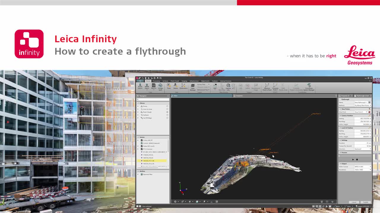
Fly Along View Points
To create a flythrough video with the Fly Along View Points method, simply open the Flythrough Creator from the status bar. You can select the starting view point, camera position, look-at position and video settings. From there, simply zoom, pan and rotate the data to create your flythrough, then preview your recording. The control panel allows you to easily adjust your settings to optimize the results before you finalise your video.

Orbit & Look Around
To use the Orbit & Look Around method, select the Orbit method in the Flythrough Creator. Navigate to the desired position in the view pane and select the “Use current view” icon. When the video is played, the camera will orbit around the specified location. You can also select a specific point or feature and use it as the “look at” position. You can adjust the camera position and zenith angle to provide the best view of the project.

Fly Along Feature
The Fly Along Feature method allows you to select a linear object as the flythrough path. After selecting this method in the Flythrough Creator, use the tools to specify the feature for the “look at trajectory.” You can move the vertical camera position up or down, determine the length and horizontal offset, and modify the duration and direction to further refine your flythrough.
使用正确的工具,您可以轻松地创建简单而专业的数据演示文稿,使您的调查达到新的水平。观看视频,以更详细地查看每种方法。
Discover more surveying solutions that can help your business thrive.

Online Learning
Leica Geosystemshas developed an online learning platform, to further educate customers to use the functionality of their instruments to the maximum.
Leica Geosystemshas developed an online learning platform, to further educate customers to use the functionality of their instruments to the maximum.

Contact Leica Geosystems
找到您的Leica Geosystems联系,以获得销售,支持和技术服务。
找到您的Leica Geosystems联系,以获得销售,支持和技术服务。